We offer a full range of design services through our partner, MX Track Design Services, LLC. Our Track Design process leverages precision GPS equipment, digital mapping tools, and CAD software to develop a design that aligns with your goals and reflects the unique characteristics of your site. Designs progress from initial concept through refined, layout-ready plans that support accurate field implementation. Design services are typically incorporated for projects requiring permitting, project approvals, or detailed planning and are performed in conjunction with construction.
Our Approach
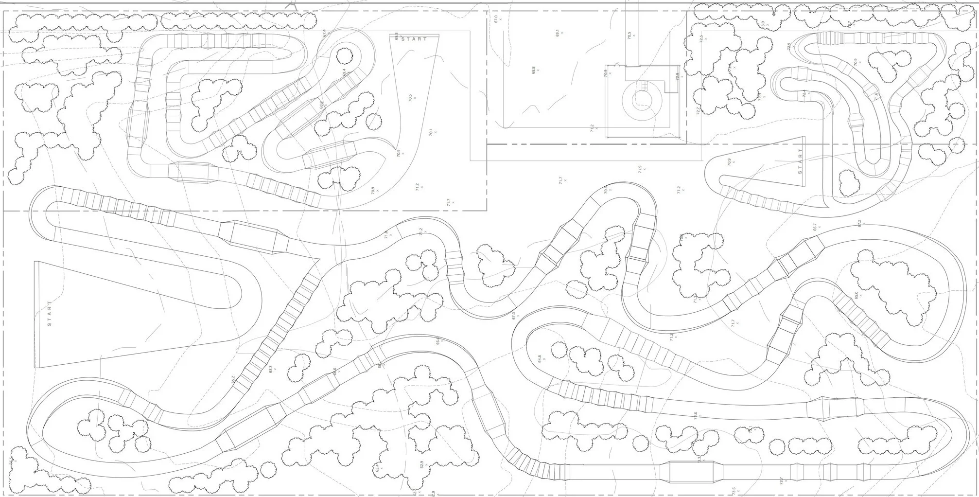
Site Mapping
The proposed track area is mapped to evaluate terrain, elevation changes, and topography, guiding efficient use of space for jumps, berms, and other track features.
Track Alignment
Leveraging georeferenced site data collected in the field, a track alignment is developed to follow the land’s natural contours and establish the foundation for a well-integrated design.
Feature Development
The alignment is refined through client feedback, with track features strategically developed and integrated into the layout. Adjustments are made to ensure alignment with project goals, rider experience, and overall track flow.
Final Design & CAD Development
The approved design is finalized and translated into a detailed CAD layout, ensuring accurate scaling, alignment, and coordination of all track elements.
Layout File & Field Preparation
The final design is converted into a point-based layout file with real-world coordinates, providing precise reference points for accurate field implementation and construction.
Supplemental Design Services
Depending on project scope and complexity, supplemental design services may be incorporated to support permitting, engineering, and construction planning.
Site Plan: Detailed layout of the track and its surrounding features, including access roads, parking, spectator areas, buildings, utilities, and other key elements.
Grading Plan: A plan outlining necessary grading work to shape the track and ensure proper flow and drainage.
Earthwork Calculations: A breakdown of material volumes, cut/fill estimates, and dirt movement requirements.
3D Track Diagram: A detailed digital model showcasing the track’s layout, features, and elevation changes for a realistic visual representation.
Irrigation Design: Design of irrigation systems to maintain moisture levels, control dust, and support consistent track conditions.
Erosion & Sediment Control Plan: Measures for managing soil erosion and runoff during construction and use.
Stormwater Pollution Prevention Plan (SWPPP): A strategy to control stormwater runoff and prevent pollution during construction and operation.
Feasibility Study: Evaluates the practicality of building a motocross track, considering market demand, costs, revenue, legal and environmental factors, and competition.